Koulou Gold Corp.
1570 – 1111 West Georgia Street,
Vancouver, BC V6E 4M3
Canada
info@koulougoldcorp.com
Assuéfry Project
Regional geology showing the Assuéfry Project location, the Koun-Fao Project Applications outline, and Endeavour Mining's Assafou deposit resource outline*
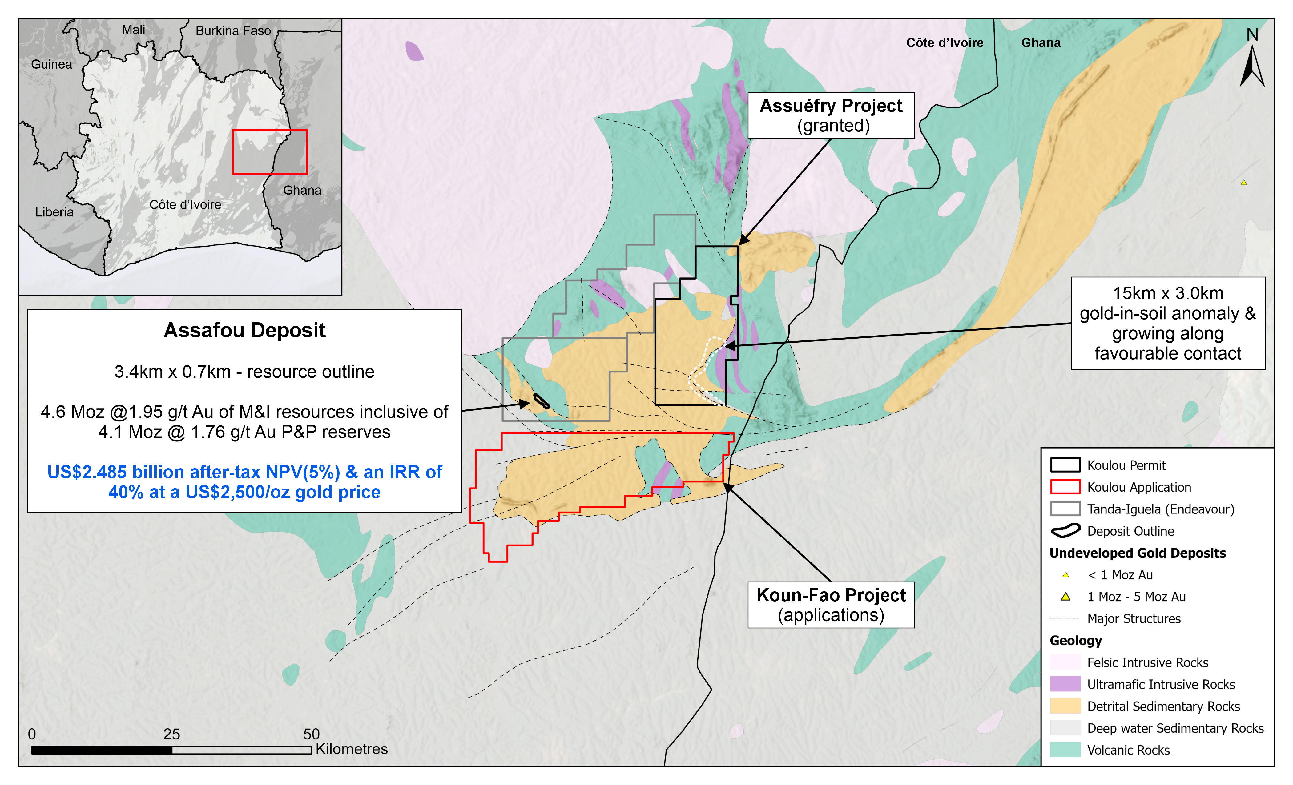
*Endeavour Mining plc. (2024). Assafou Project - Positive PFS Results